Maps of the Byzantine Empire for Vatopedi Monastery
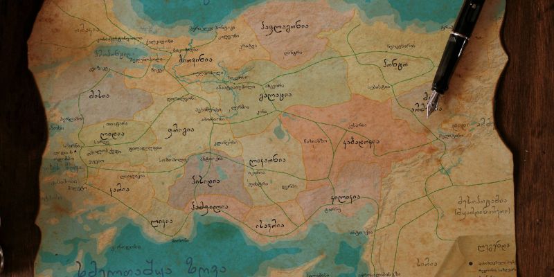
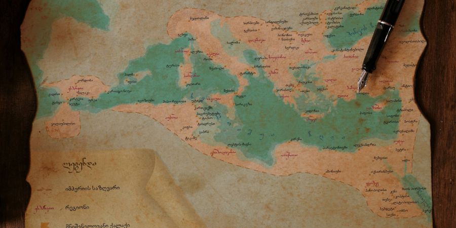
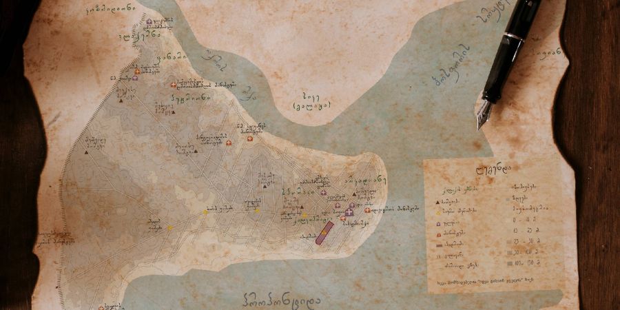
Another interesting project, which our team carried out in collaboration with the Vatopedi Monastery on Mount Athos, involves the creation of three historical maps. Maps of Asia Minor and Constantinople were prepared during the Byzantine Empire, as well as a map of the borders of the entire empire as of 555. The maps will be published in a book published by the Vatopedi Monastery about the life of St. Theodore.
The maps show the main regions of the Byzantine Empire at that time, the network of Roman roads, important cities and settlements, the districts of Constantinople and the sights, also important seas, bays, straits, islands and more. The design concept is also based on the historical theme of the maps and has an antiquity effect.
Vatopedi Monastery is the second Orthodox Fathers' Monastery in the Mount Athos hierarchy, distinguished by its wealth, antiquity and extensive territories.


