Developing a Geospatial Urban Water Supply and Sanitation Utility Management System
Status: Finished
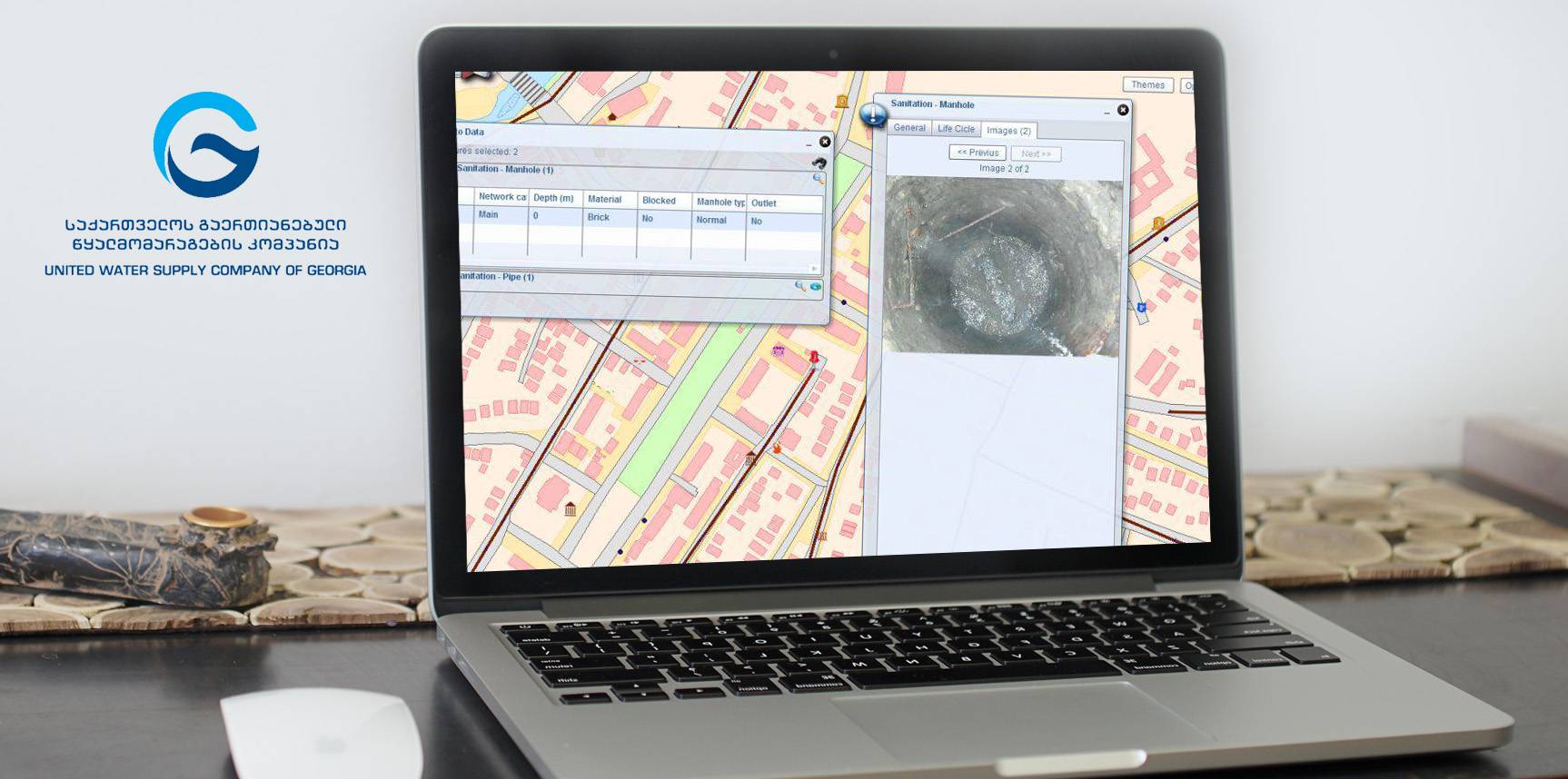
The main scope of the project was to collect Water Supply and Sanitation Asset data for the 6 selected cities of Georgia and organize them into a Web Based Geographic Information System for further planning and development of WSS Infrastructure.
The work was conducted in the cities of Kutaisi, Zugdidi, Poti, Anaklia, Mestia and Marneuli.
In scope of the project georeferenced basemaps for the project cities were updated; a database on water supply and sanitation (WSS) assets including descriptive information was created; a web-based WSS utility management system on a geographic information system (GIS) domain at the service utility's head quarters for decision making was created and successfully implemented; the staff capacity was developed by specialized and on job trainings.
Collected spatial (graphical) data included: manholes, chambers, pipes, reservoirs, pumping stations, pumps, valves, hydrants, treatment plants, water intake locations, etc. Precise geodedic eqipment was used for the survey. The precision coordinate measurements - 5cm; precision of depth measurements - 1cm.
Collected attributive data included: age, diameter, material, depth, invert levels of pipes, dimentions, asset condition, etc. The data were collected using detailed questionnaires (data model) designed by the standards similar to the standards used in the European Uniton.
The important components of the project was the detection of hidden manholes. This was acomplished using specialized detection equipment.
The following licensed software was provided to the beneficiary:
- ArcGIS Server 10 Standard, Enterprise
- ArcGIS Desktop 10 Standard Edition
- SQL Server 2008 Standard Edition
| Tasks Performed: |
Technology: |
|
|